

Powiedz znajomym o tym przedmiocie:
Rand McNally Folded Map: Dallas Fort Worth Regional Map
Rand McNally
Nasi klienci mówią:

Rand McNally Folded Map: Dallas Fort Worth Regional Map
Rand McNally
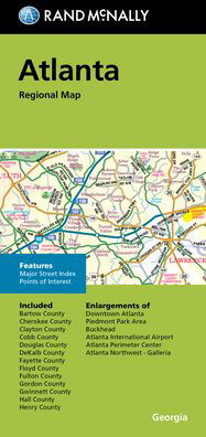
Rand McNally's folded map for Dallas Fort Worth is a must-have for anyone traveling in and around this part of Texas, offering unbeatable accuracy and reliability at a great price. Our trusted cartography shows all Interstate, U. S., state, and county highways, along with clearly indicated parks, points of interest, airports, county boundaries, and streets. The easy-to-use legend and detailed index make for quick and easy location of destinations. You'll see why Rand McNally folded maps have been the trusted standard for years. -Regularly updated. -Full-color maps. -Clearly labeled Interstate, U. S., state, and county highways. -Indications of parks, points of interest, airports, county boundaries, downtown & vicinity maps. -Major attractions & Golf Courses. -Enlargements of Dallas, Fort Worth, Dallas/Fort Worth International Airport, Arlington Entertainment District. -Easy-to-use legend. -Detailed index & Major Street Index. -Convenient folded size. Coverage Area: Communities included, Arlington, Cleburne, Corsicana, Denton, Garland, Greenville, Irving, McKinney, Plano. Product Details: Measures 9.5' x 4' and folds out to 40' x 28'.
| Media | Książki Map (Mapy lądowe lub morskie) |
| Wydane | 22 września 2021 |
| ISBN13 | 9780528024429 |
| Wydawcy | Rand McNally |
| Wymiary | 102 × 226 × 12 mm · 77 g |
| Język | English |
Więcej od Rand McNally


Inni również kupili
![Cover for Preben Hansen · Turen Går Til: Turen går til Californien & Vestlige USA (Sewn Spine Book) [5. wydanie] (2021)](https://imusic.b-cdn.net/images/item/original/578/9788740063578.jpg?preben-hansen-2021-turen-gaar-til-turen-gaar-til-californien-vestlige-usa-sewn-spine-book&class=scaled&v=1623395637)
![Cover for Anne Hjernøe · Stærk, let og mæt (Bound Book) [1. wydanie] (2019)](https://imusic.b-cdn.net/images/item/original/526/9788740046526.jpg?anne-hjernoee-2019-staerk-let-og-maet-bound-book&class=scaled&v=1614761186)
![Cover for Dee Brown · Bury My Heart at Wounded Knee: An Indian History of the American West (Paperback Book) [1st edition] (2007)](https://imusic.b-cdn.net/images/item/original/843/9780805086843.jpg?dee-brown-2007-bury-my-heart-at-wounded-knee-an-indian-history-of-the-american-west-paperback-book&class=scaled&v=1410186719)


Zobacz wszystko od Rand McNally ( np. Paperback Book , Map , Hardcover Book , Book i Spiral Book )