

Powiedz znajomym o tym przedmiocie:
Rand McNally Easy to Read: Delaware, Maryland State Map
Rand Mcnally
Nasi klienci mówią:

Rand McNally Easy to Read: Delaware, Maryland State Map
Rand Mcnally
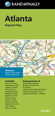
Rand McNally's folded map for Delaware and Maryland is a must-have for anyone traveling in or through these states, offering unbeatable accuracy and reliability at a great price. Our trusted cartography shows all Interstate, U. S., state, and county highways and much more. - Points of interest. - State Park chart. - State mileage chart. - Driving times map. - On-the-road toolbox. - Visitor center information. - Climate data. - State facts & symbols. - Easy-to-use legend. Coverage Area Detailed maps include: Dover, DE; Wilmington, DE; Annapolis, MD; Baltimore, MD; Baltimore Downtown, MD; Frederick, MD; Hagerstown, MD; Washington, D. C., Washington, D. C. Downtown. Product Details: Measures 9.0 x 4.125 and folds out to 25.5 x 36.75.
show more
| Media | Książki Paperback Book (Książka z miękką okładką i klejonym grzbietem) |
| Wydane | 16 maja 2022 |
| ISBN13 | 9780528025686 |
| Wydawcy | RAND MCNALLY |
| Wymiary | 250 g (Waga (szacunkowa)) |
| Język | English |
Więcej od Rand Mcnally


Inni również kupili
![Cover for Preben Hansen · Turen Går Til: Turen går til Californien & Vestlige USA (Sewn Spine Book) [5. wydanie] (2021)](https://imusic.b-cdn.net/images/item/original/578/9788740063578.jpg?preben-hansen-2021-turen-gaar-til-turen-gaar-til-californien-vestlige-usa-sewn-spine-book&class=scaled&v=1623395637)
![Cover for Ole Lund Kirkegaard · Læs selv: Læs selv Frode - og alle de andre rødder (Bound Book) [4. wydanie] [Indbundet] (2010)](https://imusic.b-cdn.net/images/item/original/121/9788702094121.jpg?ole-lund-kirkegaard-2010-laes-selv-laes-selv-frode-og-alle-de-andre-roedder-bound-book&class=scaled&v=1331420409)
![Cover for Yahya Hassan · Yahya Hassan 2 (Sewn Spine Book) [1. wydanie] (2019)](https://imusic.b-cdn.net/images/item/original/866/9788702265866.jpg?yahya-hassan-2019-yahya-hassan-2-sewn-spine-book&class=scaled&v=1573199860)
![Cover for Peter Ingemann · Den Gyldne Hest (Bound Book) [1. wydanie] (2021)](https://imusic.b-cdn.net/images/item/original/526/9788702330526.jpg?peter-ingemann-2021-den-gyldne-hest-bound-book&class=scaled&v=1633520816)


Zobacz wszystko od Rand Mcnally ( np. Paperback Book , Map , Hardcover Book , Book i Spiral Book )